Synopsis:
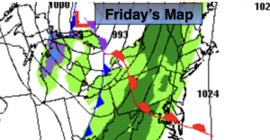
Today will feature a warm front approaching. Morning sun will give way to clouds. Showers will develop during the afternoon. It’ll be mild. A break in the rain is expected Friday night into Saturday morning. Another round of rain is expected toward midday on Saturday as another warm front moves toward the region.
Sunday will be the better half of the weekend with the sun finally returning. It’ll become windy.
It’ll turn more seasonable on Monday with the flow coming out of Canada. Readings will be near the average high of the upper 30s.
Tuesday will be pleasant with high pressure in control.
Looking down the pike, we’ll be watching for the development of low pressure somewhere along or off the East coast during the mid to late week timeframe.
Stay tuned.
Keep it here for a no nonsense, no hype forecast…
Friday:
Morning sun giving way to clouds. Showers developing during the afternoon. Mild. Highs in the lower 50s. South to Southeast winds at 5-10mph.
Tonight:
Any evening showers will end, becoming partly cloudy. Lows in the mid 40s in the City, around freezing inland. Southwest to Northwest winds at 5-10mph.
Saturday:
Rain developing by midday. Highs in the mid to upper 40s.
Sunday:
Partly sunny. Breezy. Highs in the upper 40s.
Monday:
Mostly sunny. Seasonable. Highs near 40º.
Tuesday:
Mostly sunny. Highs in the mid 40s.