Synopsis:
A front will washout over the region today. More clouds are expected from this entity with a spotty storm possible during the afternoon. This front will bring down the humidity some for Friday into the weekend. It’ll still be warm, but not as hot through Saturday. The heat will return on Sunday. All three days will feature plenty of sun.
Tropical Storm Erin continues to move through the Atlantic. Many days to watch this system as it is expected to become a powerful hurricane.
Stay tuned.
Keep it here for a no nonsense, no hype forecast…
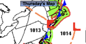
Thursday:
More clouds than sun. Spotty afternoon storms. Highs in the mid to upper 80s. Light North wind.
Tonight:
Partly cloudy. Lows in the lower 70s in the City, the 60s inland. Light winds.
Friday:
Sunny, not as humid. Highs in the mid 80s.
Saturday:
Mostly sunny. Highs in the mid to upper 80s.
Sunday:
Mostly sunny. Hot. Highs around 90º.
Monday:
Hazy, hot and humid. Spotty storm possible. Highs around 90º.