Synopsis:
High pressure will dominate our weather until further notice. The sun will rule the sky for days.
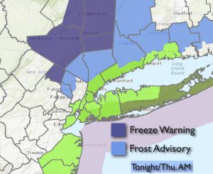
A frost and freeze is expected for our Northern counties overnight (map above).
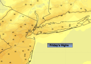
Temperatures will be around the average high of the mid 60s on Friday.
High pressure will modify and becomes a mild weather maker by the weekend and into next week. Hello 70s!
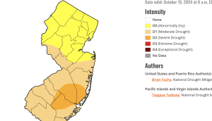
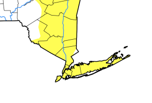
Our stretch with no rain for the month of October continues. The first two graphics above show that Southern Ocean county is in a severe drought while much of NJ and the NYC area are abnormally dry or in a moderate drought. There is no rain in the foreseeable future and these drought conditions will only worsen.
Stay tuned.
Keep it here for a no nonsense, no hype forecast.
Tonight:
Clear. Chilly. Scattered frost inland which will include a freeze in some areas. Lows in the mid 40s in the City, the upper 20s and 30s inland. North winds at 5-10mph
Friday:
Sunny. Seasonable. Highs in the mid 60s. North winds at 8-12mph.
Saturday:
Sunny. Mild. Highs around 70º.
Sunday:
Sunny. Mild. Highs in the lower 70s.
Monday:
Sunny. Warm. Highs in the mid 70s.
Tuesday:
Sunny. Warm. Highs in the mid 70s.