Synopsis:
The threat of isolated showers and storms will continue though Thursday as a Bermuda high and weak disturbance influences our weather. There will be long periods of dry time with clouds and some hazy sun.
A weak cool front will move through Thursday night (this is more of a humidity buster). Friday through the weekend will feature sunny skies, warm readings but lower humidity as an extensive area of high pressure moves overhead. Spectacular weather is on the way!
Stay tuned.
Keep it here for a no nonsense, no hype forecast.
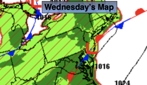
Wednesday:
Hazy, warm and humid. An isolated shower or storm. Highs around 80º. Southeast winds around 5mph.
Tonight:
Partly cloudy. Isolated showers and storms. Lows in the lower 70s in urban areas, the 60s inland. Southeast winds less than 5mph.
Thursday:
Partly sunny, warm and humid. Isolated storms. Highs in the mid to upper 80s.
Friday:
Sunny, warm and less humid. Highs in the upper 80s.
Saturday:
Sunny. Warm. Highs in the upper 80s.
Sunday:
Sunny. Very warm. Highs near 90º.