Synopsis:
A warm front will approach our region today. This will result in more clouds than sun and higher humidity. There’s a chance of scattered afternoon and nighttime showers and storms. The threat of spotty showers and storms will continue though Thursday as a Bermuda high influences our weather. There will be long periods of dry time and hazy sun.
A weak cool front will move through Thursday night (this is more of a humidity buster). Friday will feature mainly sunny skies, warm readings but lower humidity.
Stay tuned.
Keep it here for a no nonsense, no hype forecast.
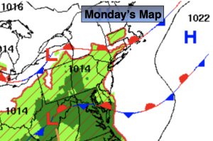
Monday:
Mostly cloudy. Scattered afternoon showers and storms possible. Much of the time will be dry. Southeast winds at 5-10mph.
Tonight:
Scattered showers and storms. Warm. Lows in the mid 70s in urban areas, the 60s inland. Southeast to Northeast winds at 5 mph.
Tuesday:
Clouds and sun. Scattered showers and storms. Highs in the lower to mid 80s.
Wednesday:
Hazy, warm and humid. An isolated PM storm. Highs in the mid to upper 80s.
Thursday:
Hazy, warm and humid. Scattered PM storms. Highs in the upper 80s.
Friday:
Mostly sunny, warm and less humid. Highs in the upper 80s.