Synopsis
Seasonable temperatures are expected today, this last day of January as high pressure sits over the Northeast. Clouds will dominate as a weak low begins to move off the Carolina coast. A few flurries are possible in the morning.
We’ll go above average with the mercury on Thursday as the lack of Arctic air continues as we turn the page to February. On Friday, Groundhog Day, a cold front will approach. A shower is possible in the morning, otherwise skies will be partly sunny with readings still above the average highs of the upper 30s. Tolerable conditions are expected for the weekend as high pressure noses in from Eastern Canada. Abundant sunshine and above average temperatures are anticipated.
There are no storms in sight. A dismal outlook for snow lovers.
Stay tuned.
Keep it here for a no nonsense, no hype forecast.
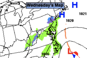
Wednesday:
Scattered morning flurries possible, otherwise remaining mostly cloudy. Highs around 40º. East/Southeast winds at 5mph.
Tonight:
Mostly cloudy. Lows in the mid 30s in the City, the upper 20s inland. West winds at 5mph.
Thursday:
Partly sunny. Highs in the mid to upper 40s.
Friday:
Clouds and sun. Spot AM shower. Highs in the mid 40s.
Saturday:
Sunny. Highs in the lower 40s.
Sunday:
Sunny. Highs in the lower 40s.