Synopsis:
The region will be dominated by high pressure through Saturday. This will result in mainly sunny skies. Readings will be at or below the seasonable levels of the mid 40s once again today. The mercury will then climb to above average as winds turn to the Southwest Friday into Saturday.
By Sunday low pressure over Florida will move North and spread clouds our way. There is a chance of showers during the afternoon. This storm needs to be watched for the potential of heavy rain Sunday night and into a part of Monday. High winds are a possibility as well. Sorry snow lovers, not an ounce of cold air with this one.
Stay tuned.
Keep it here for a no nonsense, no hype forecast.
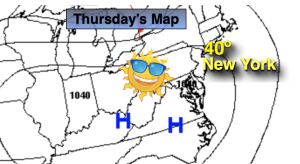
Thursday:
Sunny. Chilly. Highs around 40º. Northwest to West winds at 5-10mph.
Tonight:
Clear. Lows in the mid 30s in the City, the 20s inland. West to Southwest winds at 5mph.
Friday:
Sunny. Milder. Highs in the lower 50s.
Saturday:
Sunny. Highs in the lower 50s.
Sunday:
Increasing clouds. Chance of showers during the afternoon. Highs around 50º.
Monday:
Rain, possibly heavy in the morning. Rain most likely tapering off by afternoon. Highs in the mid 50s.