Synopsis:
A complete turnaround has occurred for today (after Thursday’s rain). Abundant sunshine, warm readings and low humidity is expected.
A fine mid-August weekend is on the way as weak high pressure well off the coast will be responsible for our smiles! I have to included the chance of an isolated thunderstorm Saturday afternoon and or evening as a disturbance moves through. Most areas will be storm-free. Sunday will be the warmer of the two days with the sun dominating.
A mix of sun and clouds is expected for Monday. The next treat of showers comes Tuesday with low pressure moving through the Northeast.
Stay tuned.
Keep it here for a no nonsense, no hype forecast.
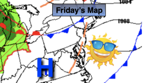
Friday:
Sunny. Highs in the mid 80s. West to Northwest winds at 8-12mph.
Tonight:
Clear. Lows around 70º in the City, the upper 50s and 60s inland. Northwest to East winds less than 5mph.
Saturday:
Mostly sunny. Isolated storm possible in the afternoon and evening. Highs in the mid 80s.
Sunday:
Partly sunny. Highs in the upper 80s.
Monday:
Partly sunny. Highs in the mid 80s.
Tuesday:
More clouds than sun. Scattered showers and storms possible. Highs in the lower 80s.