Synopsis:.
Our string of beautiful days will continue through the entire week. Temperatures will moderate rapidly as high pressure anchors itself along the East coast. June-like readings and abundant sunshine are likely through Wednesday through Friday- a Summer preview for sure!
The next threat of any showers will come on Saturday as a Southerly flow brings up some moisture. A mix of clouds and sun is expected. It will not be a washout.
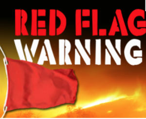
A Red Flag Warning has been issued for today for all of NYC, Long Island, Connecticut and Lower New York State. A combination of strong winds, low relative humidity, and dry fuels will create a significantly elevated fire growth potential. Please use caution with flammables outdoors.
Stay tuned.
Keep it here for a no nonsense, no hype forecast..
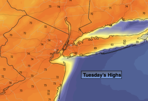
Tuesday:
Sunny, breezy and warmer. Highs in the lower to mid 70s. West to Southwest winds increasing to 15-25mph with gusts to 30mph during the afternoon.
Tonight:
Clear. Lows in the mid 50s in the City, the 40s all other locations. Light West winds 10-20mph and diminishing.
Wednesday:
Sunny. Much warmer. Highs around 80º.
Thursday:
Sunny. Very Warm. Highs in the mid 80s.
Friday:
Mostly sunny. Very Warm. Highs in the mid 80s.
Saturday:
Clouds and sun. Spotty showers possible. Highs in the mid 70s.