Synopsis:.
A delightful Easter holiday weekend is on the way. Some may call it egg-cellent! Today will feature a mix of clouds and sun as an offshore Carolina low will continue to stream on and off high clouds into the region. A sun-filled holiday is expected on Sunday. Readings this weekend will be below the average high of the upper 50s.
A heavy frost is likely overnight tonight for much of the region outside of the urban corridor. You may want to bring in those early Spring potted plants! They maybe wilted on Easter morning-and we don’t want that!
The tranquil conditions will continue through the entire upcoming week. Temperatures will moderate rapidly as high pressure anchors itself along the East coast. June-like readings and abundant sunshine are likely through Wednesday through Friday- a Summer preview for sure!
Stay tuned.
Keep it here for a no nonsense, no hype forecast..
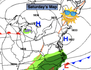
Saturday:
Clouds and sun. Cool. Highs in the lower to mid 50s. North to Southeast at 5mph.
Tonight:
Mostly clear. Cold. Lows in the upper 30s in the City, the 20s to around freezing all other locations. Light and variable winds.
Easter:
Sunny. Highs in the mid to upper 50s.
Monday:
Sunny. Milder. Highs in the lower 60s.
Tuesday:
Sunny. Warmer. Highs near 70º.
Wednesday:
Sunny. Much warmer. Highs in the 70s to around 80º.