Synopsis:
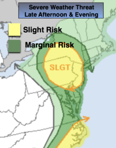
Areas of fog this morning. A cool front will approach later today with on and off showers. Most of the time it will be dry. If we’re lucky a few regions may see some sun. It’ll be mild with readings ten degrees or so above the average high of 50º. By late afternoon and evening the threat of severe weather will increase. Much of the region from NYC and to the West is in a slight risk (map above). Keep an eye to the sky for threatening weather.
Skies will become partly cloudy tonight.
Spring officially arrives on Sunday, March 20th at 11:33am EDT. Our continuation of above average temperatures will greet the new season. A mix of sun and clouds is expected behind the cool front.
Next week will start off bright and mild with high pressure in control.
The next chance of showers will come Wednesday with an approaching front.
Stay tuned.
Keep it here for a no hype, no nonsense forecast.
Catch me on The Fox Business Network from 6am-9am this weekend & on the Fox Weather Stream from 9am-Noon.
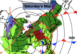
Saturday:
Mostly cloudy with areas of morning fog. Spotty showers. Much of the time will be dry. Scattered strong to severe thunderstorms are possible later today and this evening. Highs in the lower 60s to mid 60s. Southeast winds at 5-10mph.
Tonight:
Becoming mostly cloudy. Lows around 50º in the City, the 40s elsewhere. West wind at 5mmph. .
Sunday:
Partly sunny. Highs in the mid to upper 50s.
Monday:
Mostly sunny. Highs around 60º.
Tuesday:
Mostly sunny. Highs in the mid 50s.
Wednesday:
Mostly cloudy with showers likely. Highs around 50º.