Synopsis:
March will come in like a lamb. The weather pattern into the first few days will be tranquil. There are no storms on the map. A cold front will pass through Thursday morning. Areas of high pressure will continue to dominate our weather through into the beginning of the weekend.
Today will feature a mix of clouds and sun. It will be much milder with readings getting just above the average high of 46º.
All readings tonight should be above freezing.
Wednesday will be mild with abundant sunshine.
A cold front will swing Wednesday night into early Thursday morning accompanied by scattered rain and snow showers.
Cooler readings are expected for the rest of the week into the beginning of the weekend with the sun dominating.
Keep it here for a no hype, no nonsense forecast.
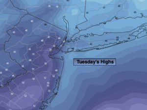
Tuesday:
Clouds and sun. Milder. High in the mid to upper 40s. South winds at 8-12mph.
Tonight:
Mostly cloudy. Lows in the 30s throughout. Southwest to Northwest winds less than 5mph.
Wednesday:
Partly sunny. Milder. High around 50º.
Thursday:
Mostly sunny. Colder. High around 40º.
Friday:
Mostly sunny. High in the upper 30s.
Saturday:
Partly sunny. High in the lower to mid 40s.