Synopsis:
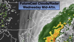
Cool August weather will continue today. Temperatures and humidity levels will be low by August standards. An offshore stationary front and a ripple of low pressure developing along it will result in cloudy skies today. Some filtered sun is possible from time to time. There will be an area of rain just off the coast. This band of precipitation may just graze the coast. Some coastal areas may remain dry while others get showered on. Inland areas will remain rain-free.
As the low moves up and off the coast a period of steadier rain is possible for Eastern Long Island later today and especially tonight.
Thursday’s forecast has turned more optimistic as drier air will move quickly in from the Northwest. Skies will become partly sunny.
Friday through the weekend looks warm and sunny as a more typical pattern for August begins to setup as high pressure builds along the East coast. Humidity levels will increase later in the weekend. Summer will have returned!
Keep it here for a no nonsense, no hype forecast.
Today:
Cloudy. Showers possible along the immediate coast. Highs in the mid to upper 70s. Northeast to East winds at 5-10mph.
Tonight:
Becoming partly cloudy with the exception being areas to the East of the City. Eastern Long Island will most likely experience a period of rain. Lows in the mid 60s in urban areas, the 50s inland. North winds at 5mph.
Thursday:
Becoming partly sunny. Highs in the lower 80s. North winds at 5mph.
Friday:
Mostly sunny. Warmer. Highs in the mid 80s.
Saturday:
Partly sunny. Highs in the mid 80s.
Sunday:
Hazy, very warm and humid. Highs in the upper 80s.