Synopsis:
High pressure will build over the Western Atlantic for the beginning to middle portion of the week. Today will be more seasonal (a few degrees shy of normal) under mainly sunny skies. Average highs are in the mid 80s. A southerly flow around the high will increase the heat and humidity under hazy skies Tuesday and Wednesday. It will once again become quite uncomfortable. A spot storm is possible by Wednesday afternoon.
On Thursday, a weakening cool front will approach with a better chance of showers and storms. This also bring relief from heat.
Tropical Storm Elsa is forecast to move up and off the coast on Friday. A few showers are possible, but at this time no major affects, besides rough surf, will occur.
Stay tuned.
Keep it here for a no nonsense, no hype forecast.
Today:
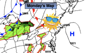
Mostly sunny. Warmer. Highs in the lower to mid 80s. Southeast winds at 5-10mph.
Tonight:
Mostly clear. Lows in the lower 70s in the City, the 60s inland. Southwest winds at 5mph.
Tuesday:
Hazy, hot and humid. Highs in the lower 90s. Cooler at the coast. Heat index: 98º-103º.
Wednesday:
Hazy, hot and humid. Spotty PM Storm. Highs in the lower 90s.
Thursday:
Warm and humid with scattered showers and storms. Highs in the mid 80s.
Friday:
Sun and clouds. A few showers are possible. Highs in the mid 80s.