Synopsis:
The 4th of July will be the better half of the weekend. More sunshine and milder readings are anticipated. An isolated shower or storm is possible as the upper level low finally moves out of the region. Readings will still be around ten degrees below the average high of the mid 80s. A comfortable holiday for sure. Happy 4th of July!
High pressure will build over the Southeastern portion of the nation for the beginning to middle portion of the week. Monday will be more seasonal. With a southerly flow around the high increasing heat and humidity under hazy skies with be will us through Wednesday. A spot storm is possible by Wednesday afternoon.
On Thursday, a cool front will approach with a better chance of showers and storms. This also will result in relief from heat.
Stay tuned.
Keep it here for a no nonsense, no hype forecast.
4th of July:
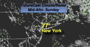
Partly sunny. An isolated shower or storm. Highs in the mid to upper 70s. Northwest to East winds at 5-10mph.
Tonight:
Mostly clear and comfortable. Lows in the mid 60s in the City, the upper 50s inland. Southeast to East winds at 5mph.
Monday:
Mostly sunny. Much warmer. Highs in the lower to mid 80s.
Tuesday:
Hazy, hot and humid. Highs in the lower 90s.
Wednesday:
Hazy, hot and humid. Spotty PM Storm. Highs in the lower 90s.
Thursday:
Warm and humid with scattered showers and storms. Highs in the mid 80s.