Synopsis:.
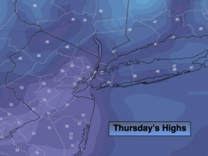
A brighter day is expected for today as high pressure moves in. Readings should be near average for the day which is in the lower 50s.
A cold front will approach Friday. Ahead of it it’ll be mild under a mix of sun and clouds. An isolated shower is possible later in the day.
Saturday will start off with sun but clouds will roll in for the second half of the day. Low pressure will move to the Northeast out of the Central Appalachian states. Rain is likely to develop from Southwest to Northeast early Saturday night.
The models develop an upper level low with the surface low pressure. If conditions are just right enough cold air may be brought down from the upper atmosphere to change the rain to areas of freezing rain well inland Saturday night and Sunday morning. The storm will move South of Long Island and toward Cape Cod. At this time the models have trended away from the possible wet snow solution. But this is not etched in stone.
The rain or mix of freezing rain well inland should end by midday. The sun should return for a time during Sunday afternoon.
Stay Tuned.
Keep it here for a no hype, no nonsense forecast.
Today:
Mostly sunny. Highs around 50º. Northwest to Southwest winds at 5-10mph.
Tonight:
Mostly cloudy. Not as cold. Lows in the mid 40s in the City, the 30s North and West. Northwest winds at 10-15mph.
Friday:
Sun and clouds, milder. Spotty PM showers. Highs in the mid to upper 50s.
Saturday:
Morning sun will give way to afternoon clouds. Highs in the mid to upper 40s.
Sunday:
Morning rain, areas of freezing rain possible North & West. Skies should brighten during the afternoon. Highs in the mid 40s.
Monday:
Partly sunny. Highs around 50º.