Synopsis:
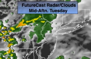
Weak low pressure will move toward the area today from the West. Showers and spotty afternoon storms are likely, especially in the afternoon. It’ll be much cooler with readings several degrees below the average of 73º.
High pressure will build along the East coast for the remainder of the week and the beginning of the Memorial Day Weekend. Skies will be mainly Sunny with readings above average. A nice stretch is on the way.
Stay tuned.
Today:
Mostly cloudy. Scattered showers and thunderstorms mainly in the afternoon. Cooler. Highs in the upper 60s. East winds at 5-10mph.
Tonight:
Scattered showers and storms Lows around 60º in the City, the 50s inland. Southeast to West winds less than 5mph.
Wednesday:
Early clouds will give way to partly sunny skies. Highs in the upper 70s.
Thursday:
Sunny. Highs in the upper 70s.
Friday:
Sunny. Warmer. Highs in the lower 80s.
Saturday:
Partly sunny. Warm. Highs in the mid 80s.
Keep it here for a no nonsense, no hype forecast.