Synopsis:
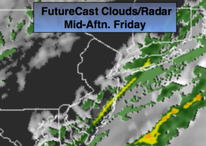
Early fog in spots will lift. A low over Central PA will move rapidly into Southeastern Canada by this afternoon. This system looks weak and shouldn’t add to much more than a few showers today under a mix of clouds and some sun as a cool front moves through. Temperatures will be in the 40s to the North and East, the 60s to the South of the City. Passover begins this evening at sundown 7:19PM.
The Holiday Weekend is looking good with a decent amount of sunshine and seasonal readings. A cool front will move through Easter Sunday uneventful.
The latest computer models bring a rapidly moving ripple of low pressure just to the South of the City Monday morning. At this time there is a low threat of a few hours of snow Monday morning. This will not be significant. I’ll be more confident that this will occur if today’s models keep the same scenario.
Stay tuned.
Today:
Patchy fog this morning in spots, otherwise, clouds and some sun. Spotty showers. Highs in the 40s North and East, 50s in the immediate NYC vicinity and the 60s to the South. Winds becoming Northwest at 8-12mph.
Tonight:
Clearing skies. Lows in the upper 30s in the City, near freezing North and West. Northwest winds at 10-20mph.
Saturday:
Partly sunny and seasonal. Highs in the mid 50s.
Easter Sunday:
Partly sunny. Highs in the lower to mid 50s.
Monday:
Low threat of a few hours of morning snow, otherwise partly sunny and chilly. Highs mid to upper 40s.
Tuesday:
Mostly cloudy with a chance of showers. Highs around 50º.
Keep it here for a no nonsense, no hype forecast.