Synopsis:
High pressure over Northern New England will result in dry conditions with temperatures just below average today.The average high is 53º.
A weak front and disturbance in the upper levels over the Appalachians will result in mainly cloudy skies for mid to late week. Temperatures will go above average with a Southerly flow as the high pressure forms off the Southeast coast. Showers chances will be with us this evening through Thursday. It will not be a washout and it will finally feel like Spring.
A storm will develop over the Ohio Valley Thursday night and rapidly move into Southeastern Canada by Friday afternoon. This system looks much weaker and shouldn’t cause much in the way of showers as the front will come through basically dry on Friday.
The Holiday Weekend is looking good with a decent amount of sunshine and pleasant readings.
Today:
Morning sun will give way to afternoon clouds. Scattered showers are possible by late day and evening. Highs in the upper 40s. Northeast to Southeast winds at 5mph.
Tonight:
Showers. A bit of freezing rain is possible well North and West. Lows around 40º in the City, the 30s inland. South winds at 5mph.
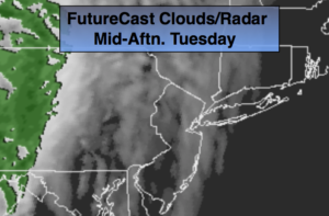
Wednesday:
Mostly cloudy with a chance of showers. Highs around 50º.
Thursday:
Mostly cloudy. Spotty showers. Mild. Highs in the upper 50s.
Friday:
Clouds and sun. Mild. Slight chance of a shower. Highs around 60º.
Saturday:
Partly sunny and seasonal. Highs in the mid 50s.
Keep it here for a no nonsense, no hype forecast.