Synopsis:
Our rollercoaster ride in temperatures will continue the next five days. From the 70s Friday, the 50s Saturday, the 60s Sunday and back to the 70s Monday. Warm fronts and cool fronts have been crossing the area every 24-36hours resulting in the big swings in temperatures.
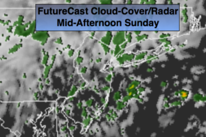
The high pressure over Eastern Canada that supplied the cool air Saturday will move off the coast allowing another warm front to move in Sunday. On and off showers and drizzle is expected throughout the day Sunday. Temperatures should pop into the 60s despite the grey skies.
Monday will be warm again with readings topping 70º ahead of another cold front. Showers are likely during the afternoon.
No major storms are in the cards during the week but it looks to turn much cooler and then much colder by Friday.
Tonight we go back to Eastern Standard Time at 2am. We “Fall Back”-don’t forget to change your clock back an hour before hitting the hay. It’s all a good time to change the batteries in your smoke detectors and carbon monoxide detectors.
Stay tuned.
Tonight:
Becoming cloudy. Areas of light rain or drizzle after midnight. Lows in the lower 50s in the City, the 40s inland. East winds at 5mph.
Sunday:
Cloudy with on and off light rain and drizzle. Mild. Highs in the lower to mid 60s. East to Southeast winds 5-10mph.
Monday:
Clouds and sun. Afternoon showers. Warm. Highs around 70º.
Tuesday:
More clouds than sun. Cooler. Highs in the mid 50s.
Wednesday:
Partly sunny and chilly. Highs around 50º.
Thursday:
Partly sunny, seasonal. Highs in the mid 50s.
Keep it here for a no nonsense, no hype forecast.