Synopsis:
The week will start off sunny and warm with low humidity. As high pressure continue to influence our weather off the East coast the humidity will increase by Tuesday along with the threat of afternoon spotty storms. Typical July conditions will be with us through Friday with a front to our North and a steamy airmass over the region. Spotty showers and storms are possible just about each day.
Stay tuned.
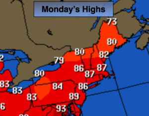
Today:
Mostly sunny with low humidity. An isolated storm is possible later today. Most areas will be rain-free. Highs in the mid 80s. Southwest wind at 8-12mph.
Tonight:
Partly cloudy, becoming muggy. Lows in the lower 70s in the City. The 60s inland. Southwest wind 55-10mph.
Tuesday:
Hazy, hot and humid. Scattered afternoon showers and storms. Some of the storms may contain strong winds and torrential rain. Highs in the 80’s to around 90º.
Wednesday:
Partly sunny. Humid. Highs in the upper 80s.
Thursday:
Hazy, warm and humid. Scattered afternoon showers and storms. Some of the storms may contain strong winds and torrential rain. Highs in the mid to upper 80s.
Friday:
Hazy, warm and humid. Spotty storms. Highs in the mid 80s.
Keep it here for a no nonsense, no hype forecast.