Synopsis:
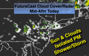
Today will start off with sun but clouds will move in as a weak disturbance moves through later in the day. Brief Isolated showers or thunderstorms are possible. Most areas will remain dry.
The first weekend of June will be a 50/50 split. Saturday will feature mainly sunny skies and seasonal readings as weak high pressure works in. Sunday will start off with some sun but showers will work in by mid-afternoon as an area of low pressure begins to affect the region from the Great Lakes. Most of Sunday looks to be dry. It won’t be a washout.
Stay tuned.
Today:
Sun and clouds. An isolated shower or late day storm is possible. Highs in the mid to upper 70s. West winds at 10-20mph.
Tonight:
A spot shower or storm, otherwise mostly clear. Lows in the mid to upper 50s in the City, the 40s to lower 50s inland. Northwest winds diminishing to 5-10mph.
Saturday:
Mostly sunny. Highs in the mid 70s.
Sunday:
Sun to clouds with scattered afternoon showers. Highs around 70º.
Monday:
Mostly cloudy with scattered showers and thunderstorms. Highs in the upper 60s.
Tuesday:
Mostly cloudy with scattered showers. Very Cool. Highs in the mid 60s.
Keep it here for a no nonsense, no hype forecast.