
Synopsis:.
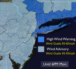
A storm is intensifying rapidly off the New England coast. This will result in strong winds into this evening. Winds could gust between 45-60mph until sunset. High wind warnings and advisories have been posted.
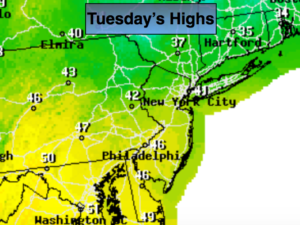
Weak high pressure will be with us tomorrow. The winds will abate. Temperatures will be near seasonal averages.
On Wednesday the Northern and Southern jet stream will be active. Both streams will contain their own upper level trough and surface low pressure as they move through and off the East coast. The systems will not phase meaning one strong storm will not form. The day will be dry.
Colder weather will move in for late week.
Tonight:
Mostly clear. Lows in the 20s throughout. Northwest winds will diminish at 10-20mph after midnight.
Tuesday:
Partly sunny. Highs around 40º. Northwest to Southwest wind at 5-10mph.
Wednesday:
Partly sunny. Highs in the mid 40s.
Thursday:
Partly sunny, colder. Highs in the mid 30s.
Friday:
Partly sunny. Highs in the upper 30s.
Saturday:
Partly sunny and mild with readings in the upper 40s.
Stay Tuned.
Keep it here for a no nonsense, no hype forecast.