Synopsis:
New Year’s weekend will be tranquil with temperatures above average. A mix of sun and clouds is expected as high pressure dominates the Northeast. A stray shower or flurry is possible at the stroke of midnight tonight as a cool front works through.
Periods of rain and drizzle are expected for the beginning of the week along with mild readings.
Looking down the pike much colder temperatures are anticipated and an area of low pressure may form along the East coast late next week or into next weekend. Could this be our first real threat? Stay tuned.
Today:
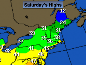
Partly sunny. Breezy. Highs in the lower to mid 40s. Southwest wind at 10-20mph.
Tonight:
Partly cloudy. A stray shower or flurry is possible. Lows in the mid 30s in the City, near 30º inland. Southwest wind at 10-15mph.
Sunday (New Year’s Day):
Mostly sunny and mild. Highs in the upper 40s.
Monday:
Mostly cloudy with periods of light rain or drizzle. Highs in the lower to mid 40s.
Tuesday:
Rain is likely. Mild with readings in the lower 50s.
Wednesday:
Partly sunny. Mild with readings in the lower 50s.
Stay Tuned.
Keep it here for a no nonsense, no hype forecast.