Synopsis:
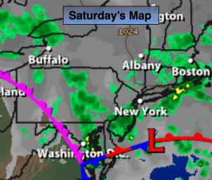
The upper low over the Mid-Atlantic and high pressure to the North that has been responsible for our grey, damp and unseasonably cool days will slowly weaken this weekend. Since systems are moving so slow grey skies will be with us as we greet October with areas of showers and drizzle just about anytime this weekend. It won’t be a washout, but not the best weather for pumpkin’ pickin’.
A second area of high pressure will move in from Eastern Canada and finally bring some much needed sunshine next week.
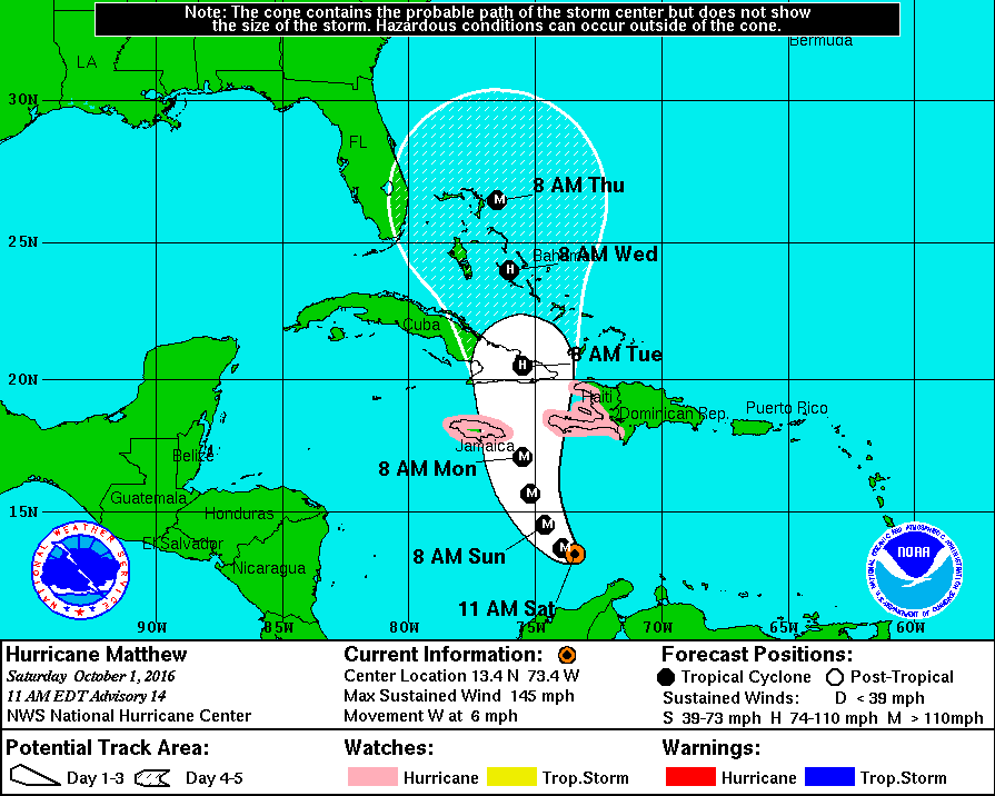
Hurricane Matthew is a powerful category 4 storm with winds of 145mph. It should turn North and be near Jamaica on Monday (map below). It is way to early to forecast if this storm will affect the Eastern Seaboard.

Today:
Cloudy with scattered showers and areas of drizzle. Unseasonably cool with highs in the lower 60s. Northeast wind at 10-15mph gusts to 20mph at the coast.
Tonight:
Scattered showers, areas of drizzle. Lows in the 50s. Northeast wind at 5-10mph.
Sunday:
Clouds with a few peeks of sun. A stray shower can’t be ruled out. Highs in the mid to upper 60s.
Monday:
Partly sunny and warmer with highs in the lower 70s.
Tuesday:
Mostly sunny and seasonal. Highs in the upper 60s.
Wednesday:
Mostly sunny. Highs in the upper 60s.
Stay Tuned.
Keep it here for a no nonsense, no hype forecast.