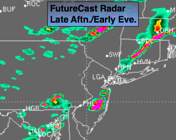
Synopsis:
A Southwest flow ahead of a cool front will result in hot and humid conditions today. The front will approach the region later this evening with spotty thunderstorms. Some of the thunderstorms maybe strong to severe. Keep an eye to the sky for threatening weather after 2pm today. More comfortable conditions are expected for midweek but the heat and humidity will return by Friday into the weekend as a potential heat wave moves in.
Today:
Hazy, hot and humid with spotty late afternoon and evening storms. Highs around 90º. Southwest wind at 10-20mph with higher gusts.
Tonight:
An isolated storm early, otherwise partly cloudy. Lows in the lower to mid 70s in the city, the lower to mid 60’s inland. Winds becoming Northwest at 5-10mph.
Tuesday:
Sunny. Not as hot and much less humid. Highs in the mid to upper 80s.
Wednesday:
A July gem. Sunny with low humidity. Highs in the lower 80s.
Thursday:
Sunny and warmer with readings in the mid to upper 80s.
Friday:
The three H’s return. Temperatures will reach the lower 90s.
Keep it here for a no nonsense, no hype forecast.